
Land Topographical Surveys
Detailed Site Mapping for Design Teams
Get a Free Quote From Us Today!
We aim to get back to you in 24 hours.
At Land Topographical Surveys, we specialise in delivering precise topographical surveys across the UK. We meticulously document land levels, boundary lines, existing structures, utilities, and other visible site features to create comprehensive survey drawings. Our services cater to architects, engineers, and developers who need accurate, detailed site information for their projects.
Get in touch today to discuss how we can assist with your topographical survey needs.
Who Is Land Topographical Surveys?
At Land Topographical Surveys, we’re experts in creating detailed topographical surveys for land and development sites. Our team is dedicated to providing accurate measurements of levels, boundaries, and site features.
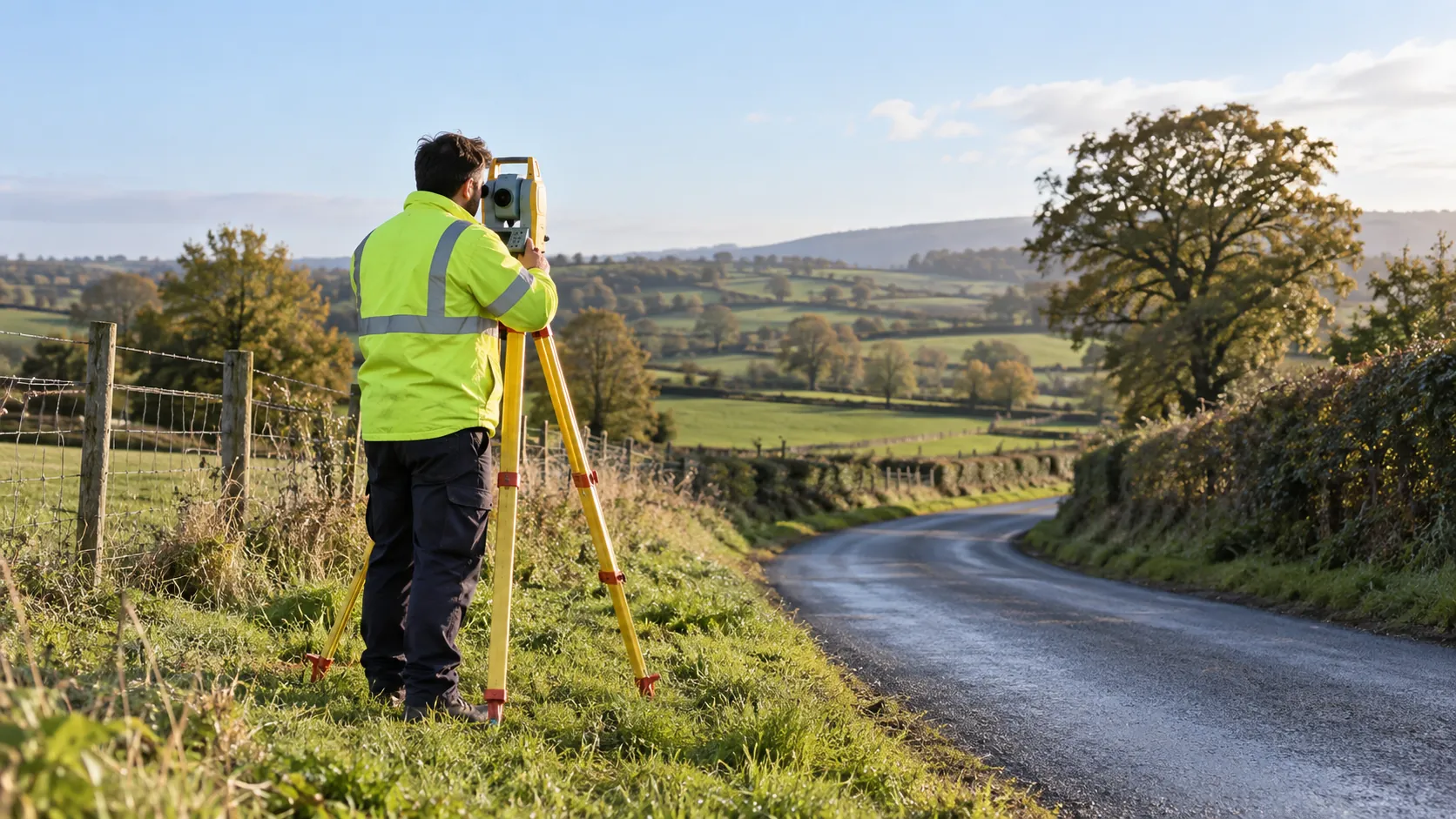
We employ advanced surveying technologies, such as total stations and GPS systems, to ensure precise data collection and geospatial accuracy. Our specialists are proficient in AutoCAD and GIS software, enabling us to deliver well-organised digital maps and 3D models.
We assist architects, engineers, and developers nationwide with reliable data crucial for informed planning and development. Our surveys also support environmental assessments, flood risk analysis, and infrastructure projects.
By adhering to RICS standards, we maintain the highest levels of quality and reliability in our deliverables. For any enquiries, please contact us to discuss how we can support your next project.
What Services Does the company Land Topographical Surveys Provide?
We offer a range of topographical surveying services to meet various project needs, employing industry-standard equipment and techniques for precise results.
- Topographical Land Surveys: We provide detailed mapping of land levels and contours, essential for site planning and development. Using technologies such as Total Stations and GNSS, we ensure high accuracy in contouring and elevation data.
- Boundary Surveys: Our surveys ensure accurate identification and recording of property lines. Using advanced GPS equipment, we help resolve disputes and confirm legal boundaries for property transactions.
- Utility Surveys: We map visible utilities for project planning, using Ground Penetrating Radar (GPR) to detect buried infrastructure like pipes and cables, which is critical in avoiding service disruptions.
- Building Surveys: Conducting detailed surveys of existing structures, we analyse their locations and dimensions. This service is vital for renovation projects and historical building preservation, providing crucial data for architects and engineers.
Each survey type is designed to address specific challenges faced by developers, contractors, and property owners. Contact us to discuss your project requirements and how we can assist.
When Is a Topographical Survey Needed?
Topographical surveys from Land Topographical Surveys are essential at various stages of a project. When planning new developments, they provide crucial information about site conditions, such as elevation changes and natural features.
Our surveys are particularly important for designing infrastructure projects, as they accurately map out land contours and gradients critical to planning roads, drainage systems, and utilities.
Additionally, topographical surveys ensure that construction stays within property boundaries, avoiding costly legal issues. They help architects and engineers verify compliance with local planning regulations and building codes, as these surveys are often needed to secure necessary permits and approvals.
Clients include developers of residential, commercial, and industrial sites, with services that ensure successful project completion. To discuss your project requirements with our expert team, please contact us today.
Get a Free No Obligation Quotation Today
How Does Land Topographical Surveys Work?
Here’s how we proceed with our topographical surveying process:
- Initial Consultation: During this phase, we discuss the scope and objectives of your project, ensuring all key elements such as property boundaries and existing structures are identified. We also establish the required standards, such as RICS or Ordnance Survey guidelines, to align with your planning needs.
- Site Survey: We conduct on-site measurements using GNSS receivers and robotic total stations for precise data capture. Our team assesses terrain features, elevations, and any natural or man-made obstacles that could impact development.
- Data Processing: Back in our office, we employ CAD software to process and analyse the collected data, creating detailed topographic maps and 3D digital models. These visualisations help stakeholders make informed decisions regarding project feasibility.
- Report Delivery: We deliver survey results in industry-standard formats, such as DWG or PDF, ready for architects and engineers to integrate into their designs. We ensure our clients receive accurate, user-friendly reports within agreed timelines.
For more information or to schedule your survey, please contact us today.
Who Does Land Topographical Surveys Help?
We help a wide range of clients including architects, engineers, property developers, and urban planners. Our surveys are fundamental to construction planning, infrastructure development, and efficient land use management across residential, commercial, and industrial projects.
For architects, we provide precise contour mapping and site measurements, which support accurate building designs and integration with the surrounding environment. Engineers rely on our detailed elevation data to assess site suitability and plan drainage or utility systems.
Property developers benefit from our boundary surveys and assessments, ensuring they maximise land potential while complying with zoning laws. Urban planners use our geospatial data to design sustainable and efficient city layouts that cater to increasing population demands.
Our involvement ensures that projects align with regulatory standards, minimising risks and fostering sustainable development. Contact us to discuss how our services can support your next project.
How Quickly Can Land Topographical Surveys Respond?
We typically respond to survey enquiries within two to three business days, maintaining flexibility to adapt to project timelines. Our team is equipped with the latest surveying technology, such as total stations and GNSS receivers, which facilitates quicker site assessments.
For urgent requests, we strive to accommodate and expedite the process where possible without compromising on accuracy and detail.
In cases where rapid turnaround is required, we can arrange priority scheduling and mobilisation of equipment and personnel. These expedited services are particularly beneficial for commercial developers who need fast, precise data for planning permissions or when there are unexpected site changes.
Rest assured, whether it is a residential development or a large commercial project, our focus remains on delivering accurate results efficiently.
How Does Land Topographical Surveys Ensure Quality and Compliance?
We adhere to industry best practices and follow relevant UK regulations such as those set by RICS and the Chartered Institution of Civil Engineering Surveyors. Our surveyors are highly trained and equipped with the latest GPS and Total Station technology, allowing us to capture accurate site data efficiently.
We use laser scanning to map out topographical features and AutoCAD software to create detailed and precise drawings that align with the needs of architects, engineers, and developers.
Our projects typically span from small residential plots to expansive commercial sites, always ensuring adherence to the Survey Association’s guidelines. We conduct thorough internal audits to maintain accuracy and regularly update our methodologies to stay current with technological advancements.
Our commitment to precision ensures high-quality output that meets stringent compliance standards. Contact us to discuss your specific survey needs.
Request a free quote
Why Choose Land Topographical Surveys?
Choosing Land Topographical Surveys means choosing accuracy and reliability. Our dedication to precise measurements and client satisfaction sets us apart.
Here are some reasons to work with us:
- Experienced Team: Our surveyors have extensive experience in topographical surveying, well-versed in using methods like terrestrial laser scanning and GPS measurement to map land features accurately.
- Nationwide Coverage: We provide services across various locations throughout the UK, ensuring even remote areas benefit from our detailed surveying, whether for large-scale infrastructure projects or smaller residential developments.
- Advanced Technology: Use of the latest equipment, such as total stations and GNSS systems, ensures precise data collection that meets industry standards like ISO 9001 for quality management.
- Comprehensive Reports: Delivering detailed, easy-to-use survey results, our reports include 3D models and CAD drawings, facilitating architects, engineers, and developers in planning and executing their projects efficiently.
Contact us today to discuss how we can support your surveying needs.
Frequently Asked Questions
What is a topographical survey?
A topographical survey maps and measures the physical features of a land area, including levels, boundaries, and existing structures, to assist in planning and development projects.
How long does a topographical survey take?
The duration of a topographical survey can vary. Typically, a small site survey may take one to two days, while larger or more complex sites could require a week or more for thorough data collection.
Can you perform surveys in remote areas?
Yes, we can conduct surveys in remote areas across the UK, ensuring accurate survey data regardless of location.
Get a Free Quote
Contact us today to discuss your project requirements and receive an accurate, no-obligation quote tailored to your needs. .
speak with our team today
What People are Saying About Us
★★★★★
“Land Topographical Surveys sent us a neat, clear plan with all the levels we needed. Would definitely use them again for our next project.”
Oliver Lowry
London
★★★★★
“The Land Topographical Surveys team were courteous and thorough on site, and their detailed plan gave our architect a reliable start. I would recommend them.”
Priya Calloway
London
★★★★★
“Really pleased with the clear, detailed site plan from Land Topographical Surveys. Exactly what we needed.”
Callum Calloway
London
★★★★★
“Such a friendly, professional team at Land Topographical Surveys, and I was really happy with the whole experience.”
Amara Hughes
London
Our Locations
We are proud to work nationally across the UK, allowing us to ensure we can provide services to you.
For a full list of counties we cover in the UK, see below.